San Francisquito Canyon. October 19, 2019. I hiked up the closed section of road to snap some photographs of the St. Francis Dam ruins. The last time I took photos there was about twelve years ago.
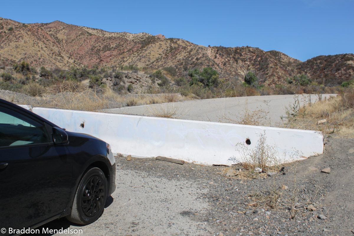
From Copperhill Drive, I drove north up San Francisquito Canyon Road for about six miles, until coming to an intersection where the new section of road branches off west, bypassing the old section, which was blocked from traffic with a concrete barricade.
I parked my car, ambled passed the barrier and began my mile-and-a-half jaunt to ground zero – the spot where once stood the engineering marvel that was the St. Francis Dam. Engineering marvel? That’s arguable. But it was big, rising 205 feet above the ground. When it collapsed minutes before midnight on March 12, 1928, the reservoir, which had been restrained by the dam’s magnificent weight, was filled to the crest with its maximum capacity of 38,000 acre feet of water; that’s over 12 billion gallons.
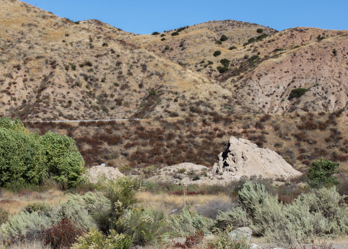
As I made my way along the decrepit roadway, huge gaps of missing pavement gave me pause. Much of the west side of the road had eroded away and crumbled into the stream bed below. I stayed on the east side. The path turned a corner, and a short while later I saw the first of the enormous concrete blocks to be carried downstream by the flood on that harrowing night 90 years ago.
Location of St. Francis Dam and Proposed Memorial Site
Closed to traffic due to its deteriorating state, the 1.5 mile journey northward to the dam site begins at this barricade.
(Photo: Braddon Mendelson, 20 Oct. 2019)
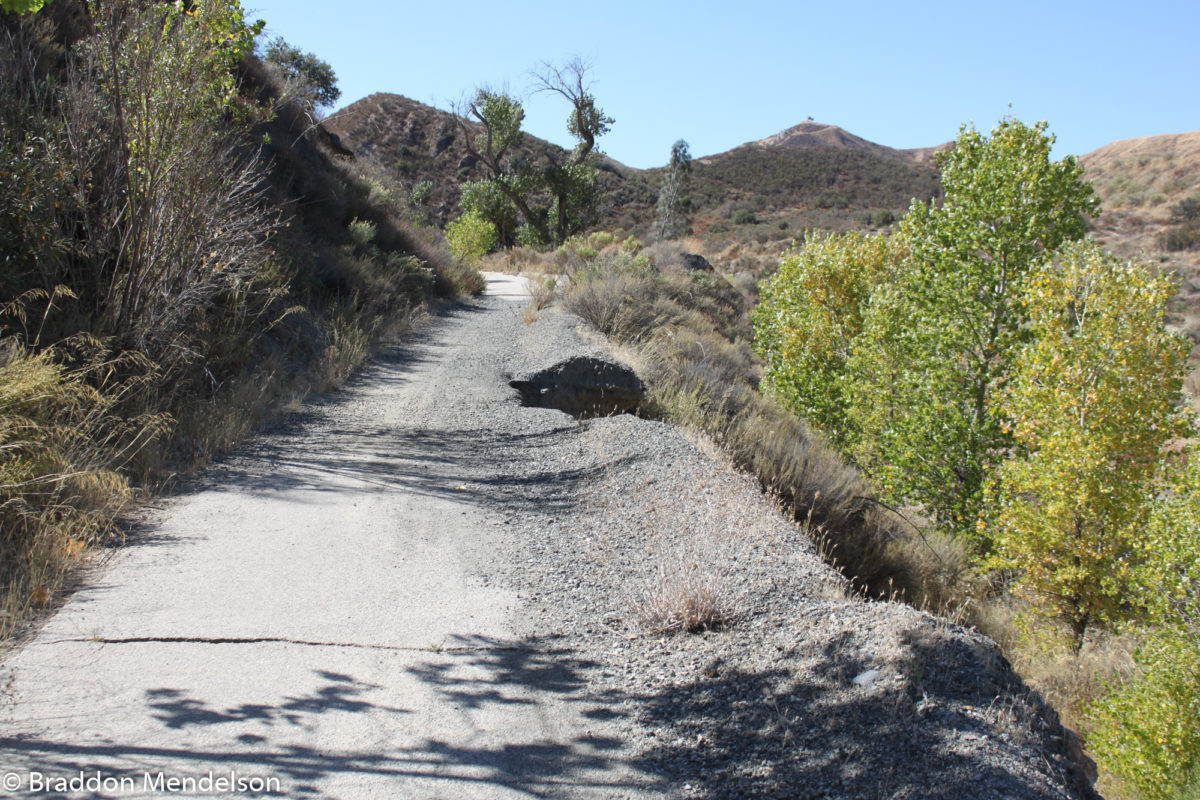
Traveling north on Old San Francisquito Canyon Road. (Photo: Braddon Mendelson, 20 Oct. 2019)
Closed to traffic for good reason.
(Photo: Braddon Mendelson, 20 Oct. 2019)
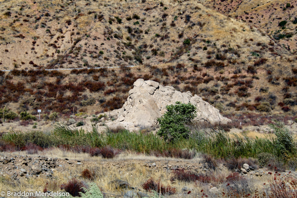
Identified in 1928 by Bureau of Water Works and Supply (BWWS) as block #29. In Governor’s Board of Inquiry Report, it was labeled as #16. This was the largest block to be moved downstream. (Photo: Braddon Mendelson, 20 Oct. 2019)
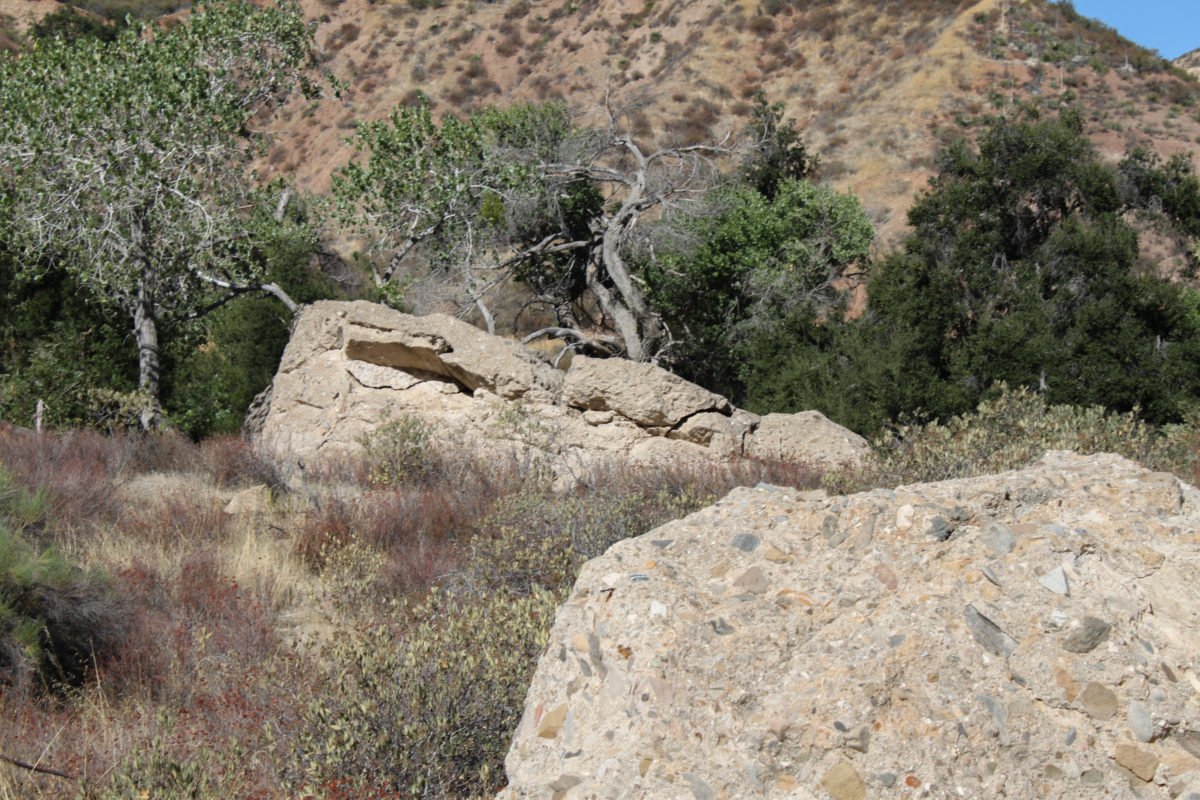
Block #44 (left) and block #43, as designated in 1928 by the Bureau of Water Works and Supply. (Photo: Braddon Mendelson, 20 Oct. 2019)
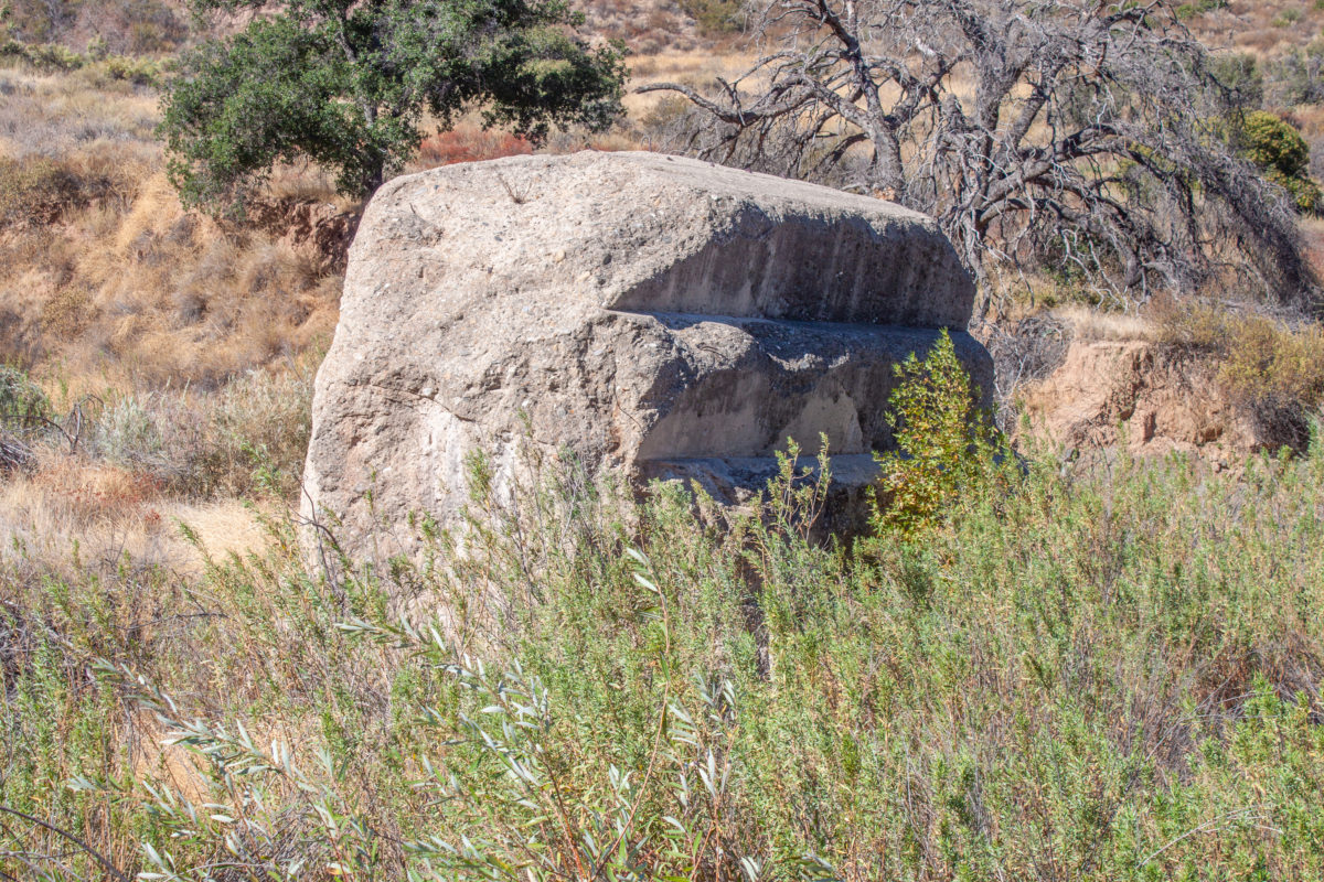
Designated in 1928 by Bureau of Water Works and Supply (BWWS) as block #43. In Governor’s Board of Inquiry Report, it was labeled as #11.
(Photo: Braddon Mendelson, 20 Oct. 2019)
Downstream rubble from the St. Francis Dam (Photo: Braddon Mendelson, 20 Oct. 2019)
Downstream Remains of St. Francis Dam. (Photo: Braddon Mendelson, 20 Oct. 2019)
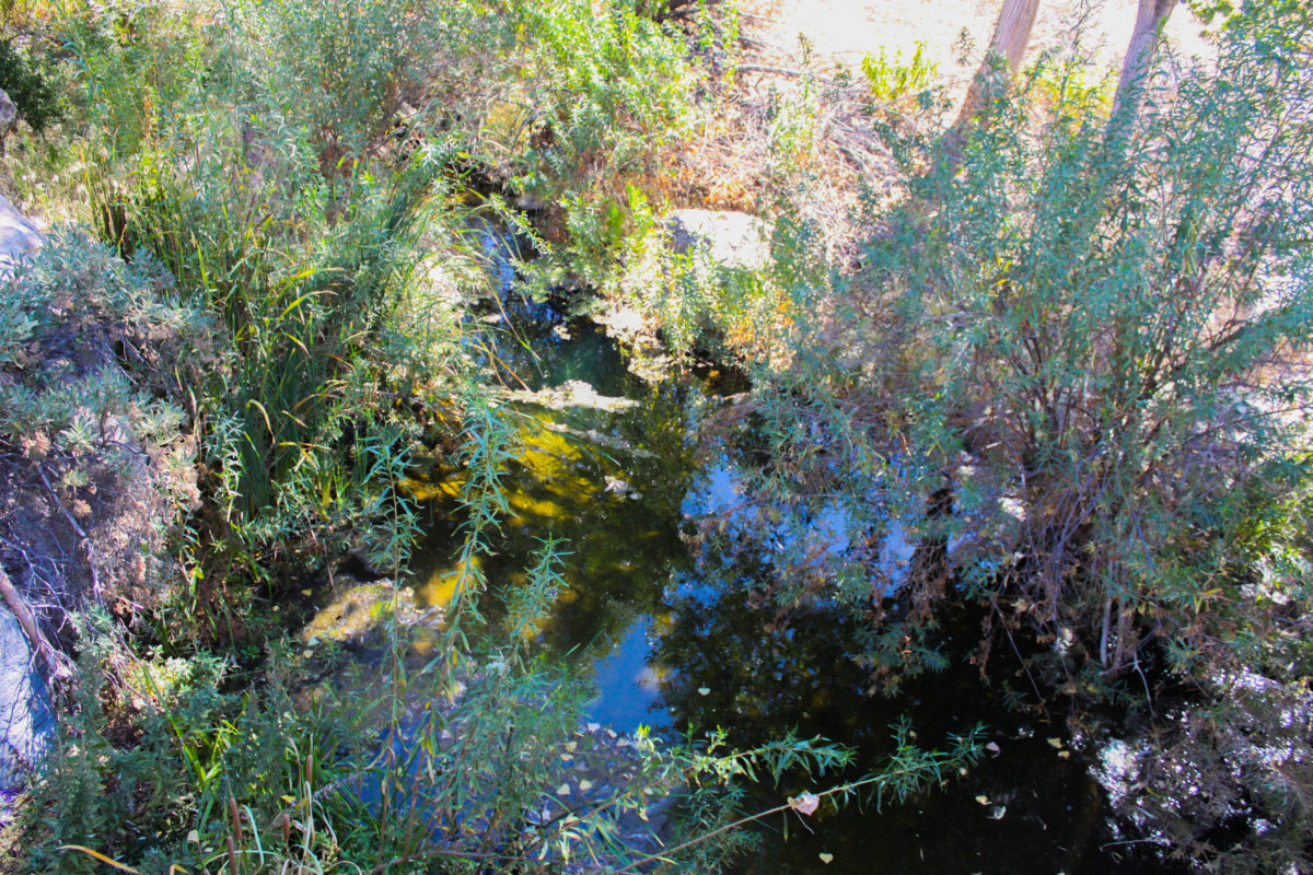
San Francisquito Creek meanders solemnly down the canyon. (Photo: Braddon Mendelson, 20 Oct. 2019)
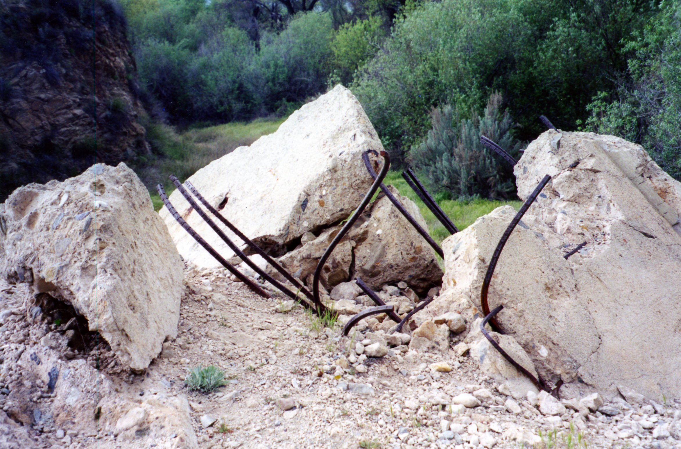
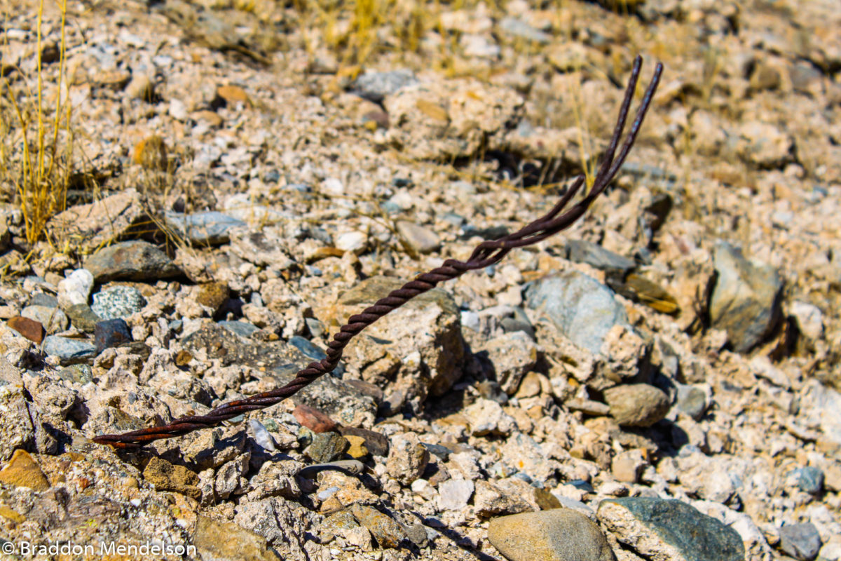
Twisted seel rebar rises from the ruins of the St. Francis Dam. (Photo: Braddon Mendelson, 20 Oct. 2019)
Twisted steel cable emerges from the rubble of the St. Francis Dam. (Photo: Braddon Mendelson, 20 Oct. 2019)
Twisted steel cable pokes from ruins of the St. Francis Dam. (Photo: Braddon Mendelson, 20 Oct. 2019)
Twisted steel cable emerges from concrete rubble of the St. Francis Dam. (Photo: Braddon Mendelson, 20 Oct. 2019)
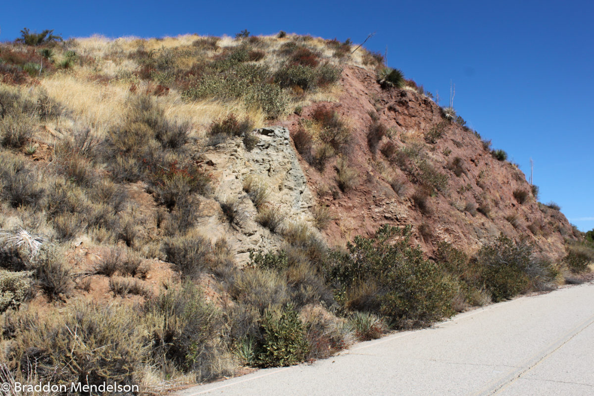
Note the red sandstone butted up against the grey composite rock. Not the best equation for stability. (Photo: Braddon Mendelson, 20 Oct. 2019)
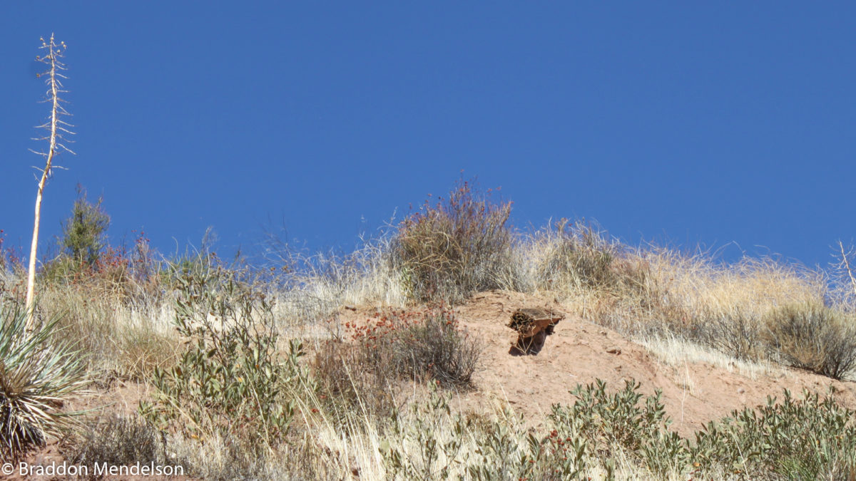
Could this be remains of dam keeper Harnischfeger’s cottage? (Photo: Braddon Mendelson, 20 Oct. 2019)
Concrete and rebar covered with sand and debris. (Photo: Braddon Mendelson, 20 Oct. 2019)
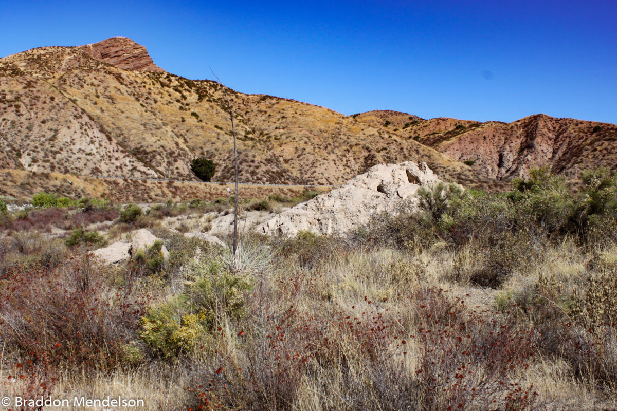
Ruins of the St. Francis Dam carried downstream by the flood. (Photo: Braddon Mendelson, 20 Oct. 2019)
Chunks of concrete rubble from the St. Francis Dam. (Photo: Braddon Mendelson, 20 Oct. 2019)
Rubble from the St. Francis Dam. (Photo: Braddon Mendelson, 20 Oct. 2019)
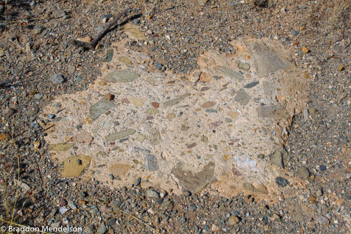
Note the aggregate, made from random riverbed rocks. (Photo: Braddon Mendelson, 20 Oct. 2019)
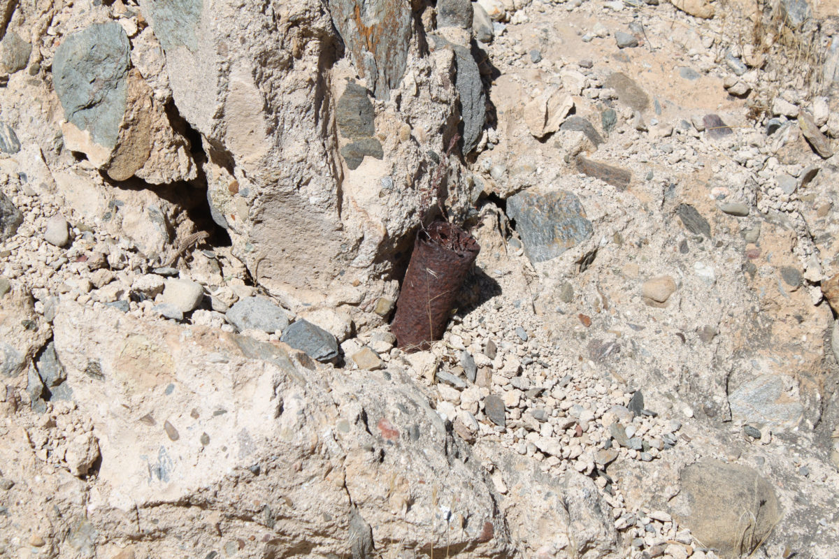
Rusted section of pipe extrudes from the ruins of the St. Francis Dam. (Photo: Braddon Mendelson, 20 Oct. 2019)
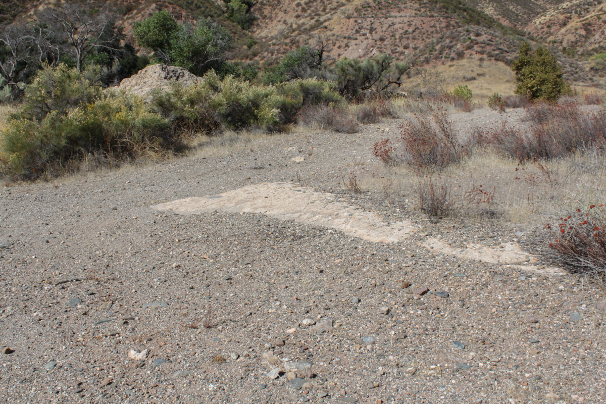
Photo of San Francisquito Creek. (Photo: Braddon Mendelson, 20 Oct. 2019)
San Francisquito Canyon Creek. (Photo: Braddon Mendelson, 20 Oct. 2019)
Banks of San Francisquito Creek. Note dam rubble in background. (Photo: Braddon Mendelson, 20 Oct. 2019)
Rubble from the St. Francis Dam. (Photo: Braddon Mendelson, 20 Oct. 2019)
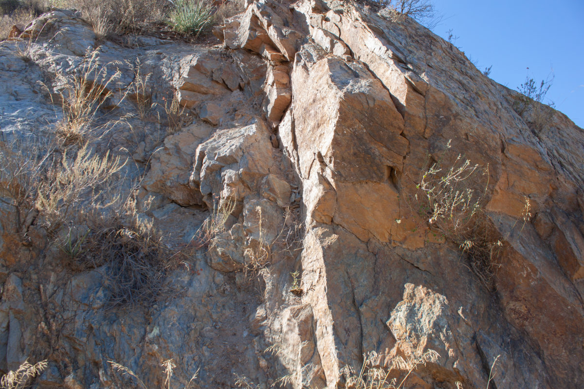
Facing west, looking upward at ruins of wing dyke of St. Francis Dam. (Photo: Braddon Mendelson, 20 Oct. 2019)
Looking up at St. Francis Dam wing dyke ruins, facing west. (Photo: Braddon Mendelson, 20 Oct. 2019)
Looking up at St. Francis Dam wing dyke ruins, facing west. (Photo: Braddon Mendelson, 20 Oct. 2019)
Looking up at St. Francis Dam wing dyke ruins, facing west. (Photo: Braddon Mendelson, 20 Oct. 2019)
Looking up at St. Francis Dam wing dyke ruins, facing west. (Photo: Braddon Mendelson, 20 Oct. 2019)
Ground Zero of St. Francis Dam Collapse. (Photo: Braddon Mendelson, 20 Oct. 2019)
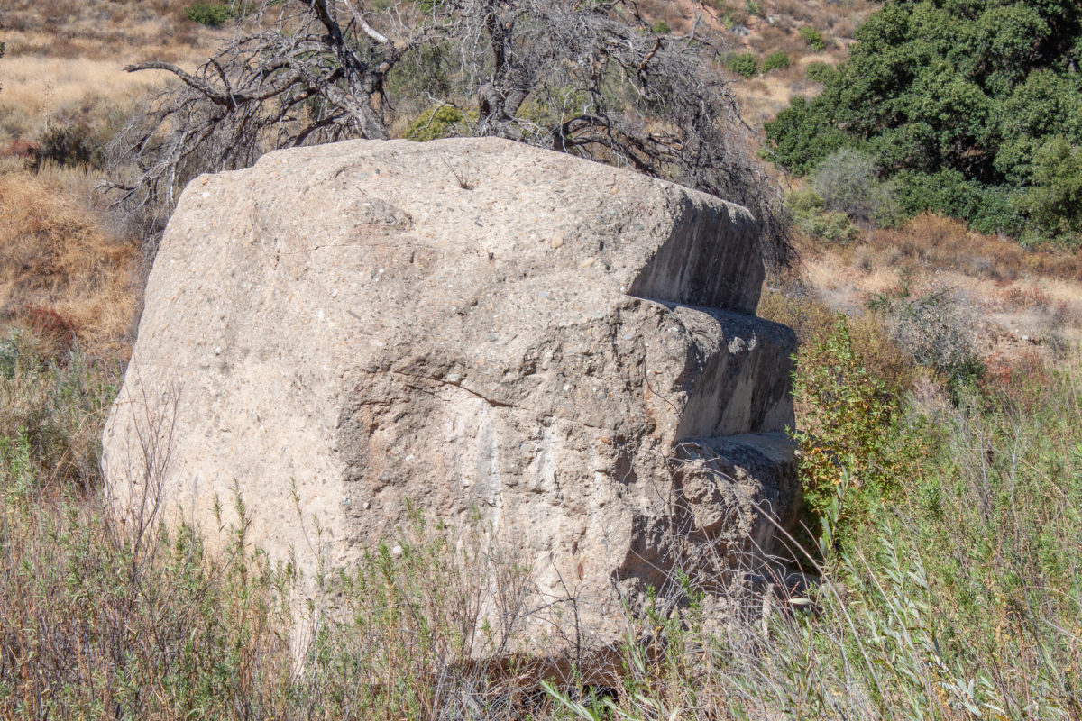
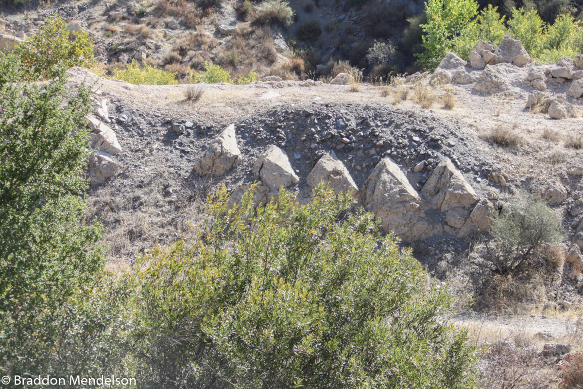
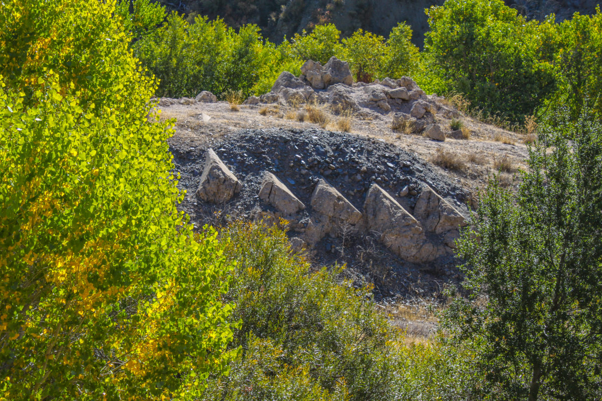
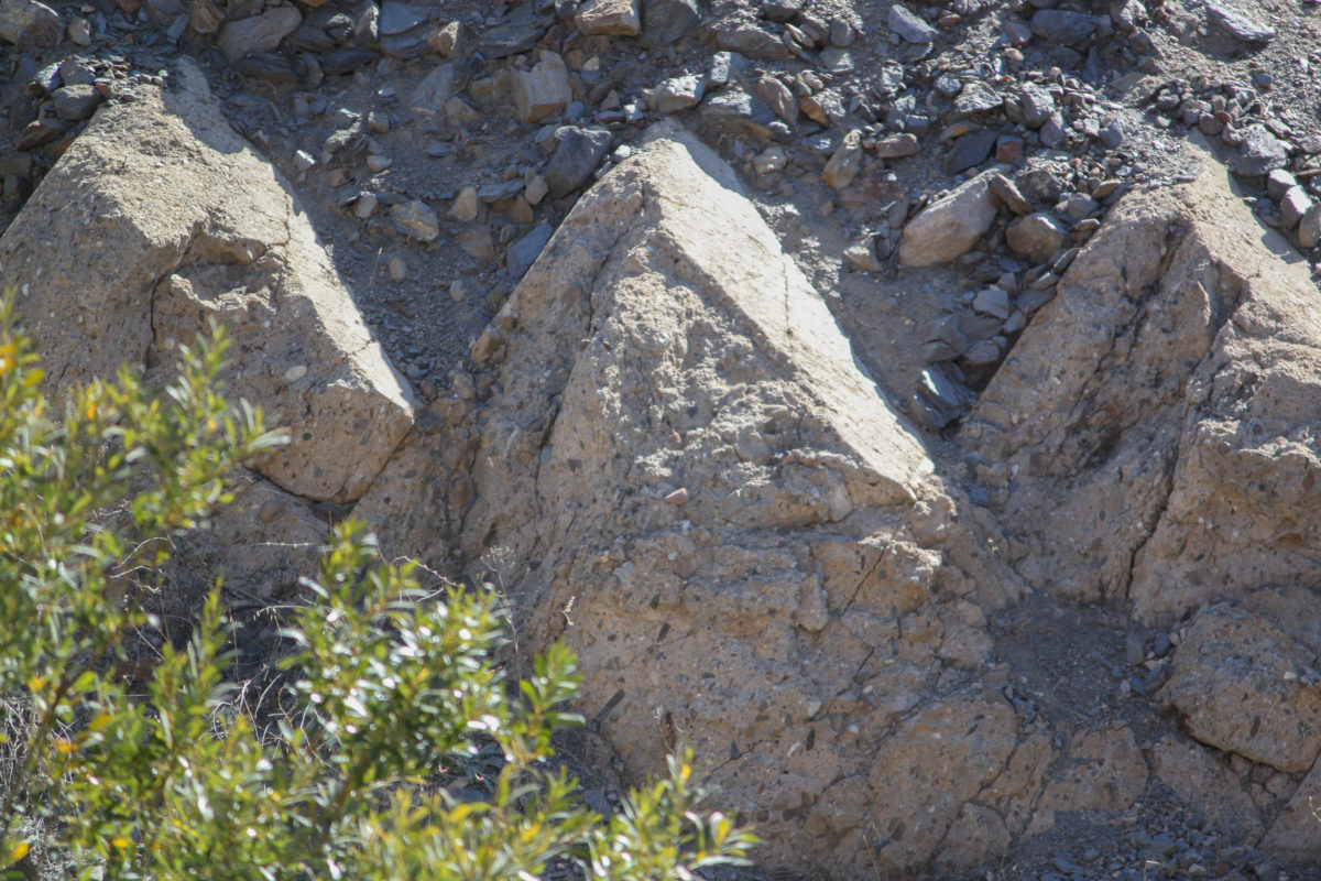
Ruins of the “steps” from the downstream face of St. Francis Dam. (Photo: Braddon Mendelson, 20 Oct. 2019)
Ruins of the “steps” from the downstream face of the St. Francis Dam. (Photo: Braddon Mendelson, 20 Oct. 2019)
Remains of the “steps” from downstream face of St. Francis Dam. (Photo: Braddon Mendelson, 20 Oct. 2019)
Ruins of the “steps” from downstream face of St. Francis Dam. (Photo: Braddon Mendelson, 20 Oct. 2019)
Ruins of the “steps” from the downstream face of the St. Francis Dam. (Photo: Braddon Mendelson, 20 Oct. 2019)
Ruins of the “steps” from the downstream face of the St. Francis Dam. (Photo: Braddon Mendelson, 20 Oct. 2019)
Ruins of “steps” from downstream face of St. Francis Dam. (Photo: Braddon Mendelson, 20 Oct. 2019)
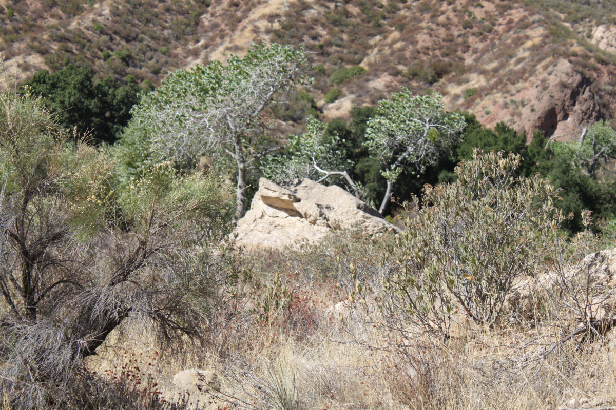
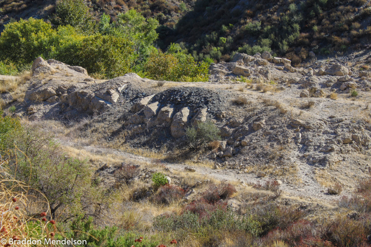
St. Francis Dam ruins, facing northwest, several hundred yards downstream. (Photo: Braddon Mendelson, 20 Oct. 2019)
St. Francis Dam ruins, several hundred yards downstream. (Photo: Braddon Mendelson, 20 Oct. 2019)
Exposed faces of concrete ruins buried deep in 90 years of dirt and debris. (Photo: Braddon Mendelson, 20 Oct. 2019)
The concrete ruins of the St. Francis Dam. (Photo: Braddon Mendelson, 20 Oct. 2019)
St. Francis Dam rubble, buried in 90 years of dirt and debris. (Photo: Braddon Mendelson, 20 Oct. 2019)
Rubble from the St. Francis Dam, covered in 90 years of dirt and debris. (Photo: Braddon Mendelson, 20 Oct. 2019)
Downstream rubble from St. Francis Dam. (Photo: Braddon Mendelson, 20 Oct. 2019)
Downstream rubble from St. Francis Dam with protruding steel pipe. (Photo: Braddon Mendelson, 20 Oct. 2019)
Rubble from the St. Francis Dam. (Photo: Braddon Mendelson, 20 Oct. 2019)
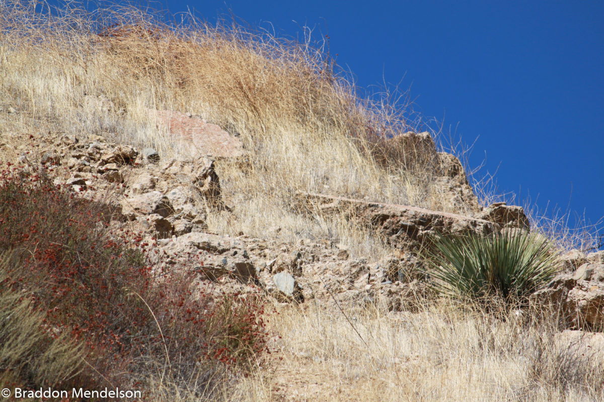
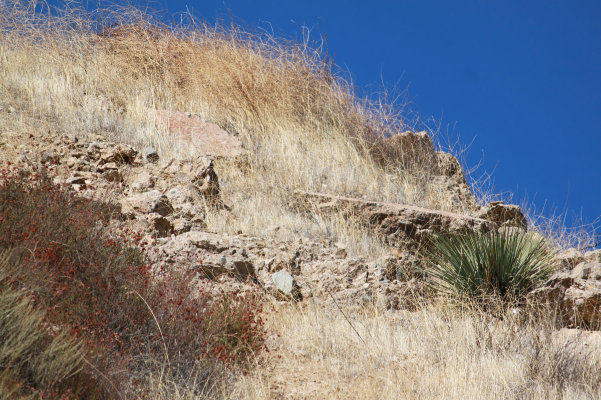
Old San Francisquito Canyon Road. (Photo: Braddon Mendelson, 20 Oct. 2019)